
BORING LOGS: Making Accurate Descriptions and Confident Correlations
This 90 minute webinar is designed to teach professionals how to make adequate soil descriptions on boring logs and correlate geologic units that have meaningful purpose to hydrogeologic, environmental or engineering projects.
The description and correlation of sedimentary successions is often complicated by the difficulty in determining the distribution, continuity, and geometries of geologic units. The key to determining the nature of subsurface units is understanding depositional units and the alterations from secondary weathering.
For example, suitable groundwater monitoring zones within the sedimentary sequence are those sorted sediments that occur as laterally extensive sand-and-gravels opposed to those sediments that occur as isolated lenses. Webinar attendees will take steps to understand the lateral or isolated nature of sediments when building the geologic framework (site conceptual model). Likewise, the key to determining the engineering properties of geologic units and building meaningful ground water models depends on the ability to map site stratigraphy
Learn to take the mystery out of the subsurface and understand the story that the sediments are telling.
This webinar will cover the following topics:
- Subsurface resolution is dependent on more than the right sampling method.
- Consequences of poor boring logs and the benefits of good ones
- Defining geologic units
- Understanding why depositional environments and secondary weathering zones are important
- Accurate descriptions that build a geologic framework
- Common mistakes and confusing terms
- Basis for correlating borings
- Tips for helping the field staff think on their feet and helping managers weave QA/QC into the fabric of projects � a financial advantage.
| Fee: |
299.00 USD Per Computer Site (unlimited participants per site).
|
| Instructors: |
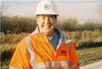
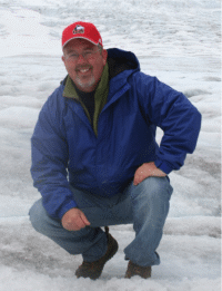
Tim Kemmis, PhD., PG and Dan Kelleher, PG, CIPM Co-Authors of "The Field Guide for Soil and Stratigraphic Analysis"
|
Pay one site (one computer) registration fee and an unlimited number of participants from your organization can attend at that site.
1.5 Professional Development Hour (1.5 PDH) for each verified attendee will be available as a Course Completion Certificate from Northern Illinois University.
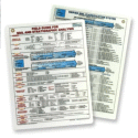 FREE FIELD GUIDE FOR SOIL AND STRATIGRAPHIC ANALYSIS V.2 with each registration (one per site). Also purchase additional field guides for special one-time discounted price in honor of this special introductory webinar!
Attendees will be invited to actively participate during this live and interactive on-line web seminar. Discussion is planned following the webinar for those who want to continue the session. Bring your questions to the webinar and present them to the instructor and other participants for exploring the best solution.
Instructors Bio
 Tim Kemmis received his bachelor�s degree in agricultural soil science from the University of Illinois and his master�s degree in glacial geology while working as a graduate assistant at the Illinois State Geological Survey.
He worked 14 years for the Iowa Geological Survey, during which he received his Ph.D., and where he:
- Carried out glacial sedimentologic investigations
- Remapped the Des Moines Glacial lobe
- Established the formal glacial stratigraphy for the lobe based on depositional environments
- Discovered a new type of hummocky glacial topography
- Determined the geometry and origin of jointing in glacial tills
- Developed a lithofacies code to decipher the history of glacial outwash and alluvial sequences
For most of the time since 1992, Tim has worked as a senior geologist consultant and project manager for large-scale hydrogeologic investigations. His unique experience as both an applied researcher and consultant has allows Tim to effectively unravel sedimentary complexities coupled with his personal ability to teach these concepts to all staff levels.
 Dan Kelleher is a hydrogeologist who strives for excellence in subsurface characterization. Dan earned his bachelor�s degree from Monmouth College and master�s degree at Northern Illinois University. His technical expertise is quantitative hydrogeology (in porous and fractured media), geotechnical analysis of sedimentary sequences, aquifer testing and predictive ground water modeling. He promotes field analysis during stratigraphic characterization from boring to boring in order to utilize QA/QC processes fully throughout a project and help identify unexpected conditions as soon as they arise.


