TAKING THE MYSTERY OUT OF COMPLEX GLACIAL SEQUENCES AT ENVIRONMENTAL AND GEOTECHNICAL SITES IN THE MIDCONTINENT
PART 1: Deciphering Stratigraphy and Depositional Environments
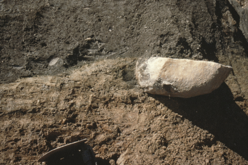
Hydrogeologists and geotechnical engineers face a common problem: how do you take the mystery out of the subsurface at sites underlain by complex glacial sequences � sequences featuring deposits from successive glacial advances with interbedded stratified meltwater deposits occurring as isolated lenses within a glacial unit or as continuous stratified units between successive glacial advances?
For hydrogeologists, a key is knowing whether the various stratified meltwater deposits are contaminant pathways through continuous units underlying the site or if they are merely isolated lenses within a fine-grained glacial unit. Related questions include:
- Where should well screens be set to monitor a contaminant pathway?
- How can the stratigraphic sequence be identified so that groundwater flow patterns beneath the site can be characterized and understood?
The questions are no less challenging for geotechnical engineers. How can the stratigraphic sequence beneath the site be determined so that the effects of site stratigraphy on foundation conditions can be assessed?
- What is the stratigraphic sequence beneath the site?
- How do I successfully sample the sequence to determine foundation conditions, cut slope stability or soil borrow source characteristics?
What does taking the mystery out of such complex subsurface conditions require? An understanding of glacial stratigraphy, glacial depositional environments, and the magnitude of any post-depositional weathering alteration.
This webinar, Part I, provides techniques for identifying and understanding glacial stratigraphy and depositional environments. These techniques are based on an understanding of glacial depositional environments, glacial sedimentology, and regional glacial stratigraphy. Join us for this webinar and learn how to take the mystery out of the complex glacial sequences underlying your environmental and geotechnical sites.
This webinar is the first part in a Three Part Series in characterizing complex glacial sedimentary successions. Register for all three and receive a special reduced rate along with complimentary field tools by Midwest GeoSciences Group.
| Fee: |
299.00 USD Per Webinar Site (unlimited participants per site)
|
| Instructors: |
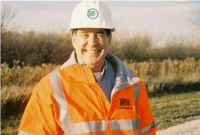
Tim Kemmis, PhD, PG, AECOM Environment, Sheboygan, Wisconsin
|
Pay one site (one computer) registration fee and an unlimited number of participants from your organization can attend at that site.
Participants will receive a handout referencing the webinar topics and discussion.
1.5 Professional Development Hour (1.5 PDH) for each verified attendee will be available as a Course Completion Certificate from Northern Illinois University.
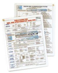
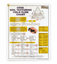
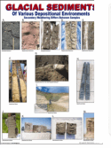
Register by 25 March 2010 for this three part webinar series and receive 3 free FIELD GUIDE FOR SOIL AND STRATIGRAPHIC ANALYSIS, 3 free USDA SOIL TEXTURING FIELD FLOW CHARTS and 3 free GLACIAL SEDIMENTS CHARTS (12" x 18") by Midwest GeoSciences Group.
Register for this webinar (without the other in the series) and receive 1 free FIELD GUIDE FOR SOIL AND STRATIGRAPHIC ANALYSIS by Midwest GeoSciences Group.
Additional field guides and flow charts may be purchased for a reduced price with early registration (see registration form for details).
Attendees will be invited to actively participate during this live and interactive on-line web seminar. Discussion is planned following the webinar for those who want to continue the session. Bring your questions to the webinar and present them to the instructor and other participants for exploring the best solution.
Click on the Image to learn more
Instructor Bio
 Tim Kemmis received his bachelor�s degree in agricultural soil science from the University of Illinois and his master�s degree in glacial geology while working as a graduate assistant at the Illinois State Geological Survey.
He worked 14 years for the Iowa Geological Survey, during which he received his Ph.D., and where he:
- Carried out glacial sedimentologic investigations
- Remapped the Des Moines Glacial lobe
- Established the formal glacial stratigraphy for the lobe based on depositional environments
- Discovered a new type of hummocky glacial topography
- Determined the geometry and origin of jointing in glacial tills
- Developed a lithofacies code to decipher the history of glacial outwash and alluvial sequences
For most of the time since 1992, Tim has worked as a senior geologist consultant and project manager for large-scale hydrogeologic investigations. His unique experience as both an applied researcher and consultant has allows Tim to effectively unravel sedimentary complexities coupled with his personal ability to teach these concepts to all staff levels.