TAKING THE MYSTERY OUT OF COMPLEX GLACIAL SEQUENCES AT ENVIRONMENTAL AND GEOTECHNICAL SITES IN THE MIDCONTINENT:
PART 3: Managing Unanticipated Subsurface Conditions in the field When Budgets Matter Most
Budget consequences for erroneous well screen placements, excessive analytical or geotechnical laboratory work, speculative and substandard subsurface characterization and failing remediation systems coupled with competitive bidding have forced environmental project managers to more closely examine the process at which we approach subsurface investigations. All of this can be avoided by �thinking on our feet� in the field.
This 90-minute webinar shows ways to identify and cope with unanticipated subsurface site conditions. It explains the benefits of �thinking on our feet� and addresses the common field problems that plague our industry. Attendees will benefit from this webinar by learning how adjusting field perspectives and procedures can improve meeting project objectives and control project t costs by:
- Identifying unexpected conditions
- Consequently, how to cope with the necessary changes needed to meet project objectives
- Minimizing wasted drilling and field efforts that would have been performed based on erroneous project scope assumptions before actual field conditions were determined
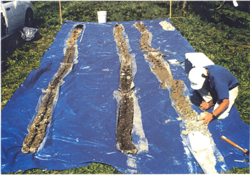
Hydrogeologic field analysis is a project management style that supports making field decisions during field activities, making sense of subsurface samples from boring-to-boring, targeting meaningful monitoring well placements, and selecting geotechnical samples that are rational and diagnostic of actual site-specific conditions. The environmental and engineering industry can benefit from field analysis procedures that occur from boring-to-boring while weaving QA/QC into the fabric of a project helping ensure project profitability and reliability.
Learn to take the mystery out of the subsurface during this webinar and understand the story that the subsurface samples are telling.
This webinar will cover the following topics:
- How to identify unanticipated subsurface site conditions, and why it�s important to the technical and financial outcome of the project.
- Consequences of not recognizing unanticipated subsurface conditions.
- Field documentation
- Field communication
- Helpful steps for field analysis, boring correlations, well screen placement and sample selection and testing.
- Roles and responsibilities of the project team
- Presenting to the client out-of-scope items and change orders when they are necessary to meet the project objectives and to save the client money in the long run.
This webinar is the third part in a Three Part Series in characterizing complex glacial sedimentary successions, but it is understandable and beneficial as a stand-alone session.
| Fee: |
299.00 USD Per Webinar Site (unlimited participants per site)
|
| Instructors: |
Tim Kemmis, PhD, PG and Dan Kelleher, PG, CIPM
|
Pay one site (one computer) registration fee and an unlimited number of participants from your organization can attend at that site.
Participants will receive a handout referencing the webinar topics and discussion.
1.5 Professional Development Hour (1.5 PDH) for each verified attendee will be available as a Course Completion Certificate from Northern Illinois University.
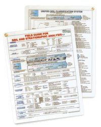
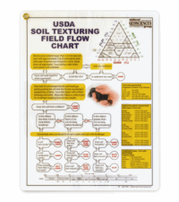
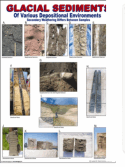
Register by 25 March 2010 for this three part webinar series and receive 3 free FIELD GUIDE FOR SOIL AND STRATIGRAPHIC ANALYSIS, 3 free USDA SOIL TEXTURING FIELD FLOW CHARTS and 3 free GLACIAL SEDIMENTS CHARTS (12" X 18") by Midwest GeoSciences Group.
Register for this webinar (without the other in the series) and receive 1 free FIELD GUIDE FOR SOIL AND STRATIGRAPHIC ANALYSIS by Midwest GeoSciences Group.
Additional field guides and flow charts may be purchased for a reduced price with early registration (see registration form for details).
Attendees will be invited to actively participate during this live and interactive on-line web seminar. Discussion is planned following the webinar for those who want to continue the session. Bring your questions to the webinar and present them to the instructor and other participants for exploring the best solution.
Click on the Image to learn more
Instructor Bio
 Tim Kemmis received his bachelor�s degree in agricultural soil science from the University of Illinois and his master�s degree in glacial geology while working as a graduate assistant at the Illinois State Geological Survey.
He worked 14 years for the Iowa Geological Survey, during which he received his Ph.D., and where he:
- Carried out glacial sedimentologic investigations
- Remapped the Des Moines Glacial lobe
- Established the formal glacial stratigraphy for the lobe based on depositional environments
- Discovered a new type of hummocky glacial topography
- Determined the geometry and origin of jointing in glacial tills
- Developed a lithofacies code to decipher the history of glacial outwash and alluvial sequences
For most of the time since 1992, Tim has worked as a senior geologist consultant and project manager for large-scale hydrogeologic investigations. His unique experience as both an applied researcher and consultant has allows Tim to effectively unravel sedimentary complexities coupled with his personal ability to teach these concepts to all staff levels.
 Dan Kelleher is a hydrogeologist who strives for excellence in subsurface characterization. Dan earned his bachelor�s degree from Monmouth College and master�s degree at Northern Illinois University. His technical expertise is quantitative hydrogeology (in porous and fractured media), geotechnical analysis of sedimentary sequences, aquifer testing and predictive ground water modeling. He promotes field analysis during stratigraphic characterization from boring to boring in order to utilize QA/QC processes fully throughout a project and help identify unexpected conditions as soon as they arise.