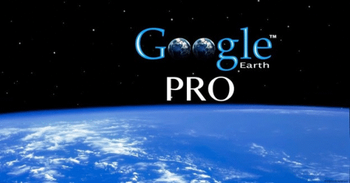
THE GOOGLE EARTH PRO AND ARCGIS REVOLUTION: PART 6: The Future of Communication, Project Planning, and GIS
Google Earth is changing the way we view the world and GIS data. Google Earth Pro is now free. 3D visualization, enhanced display, and analysis of your GIS data now takes on a new level of sophistication and capability. It is only one of the many free integrated Google Tools that can enhance workflow and client communication.
Register now and prepare to discover how Google Earth Pro is revolutionizing the environmental and engineering industry. And learn how to use the cloud technologies to connect with your GIS data and appreciably expedite work flow.
Life and Work Is Getting Easier, and Better
Each consecutive module builds upon the previous one, beginning with an orientation of the Google Earth Pro (now available for free!), followed by a session on how to couple it with ESRI's ArcMap to enhance your GIS capabilities. The webinar series continues with sessions providing technical insights related to meaningful visualization technologies and cloud communication tools (Trimble's SketchUp and Google's new Fusion Tables) - both free tools. It then progresses with Google Apps for optimizing your ArcGIS projects. The series concludes with demonstrations of additional free Google offerings (360° Street View, Hangouts, My Maps...) and how they can possibly expedite your client communication and GIS project management.
Part 6: The Future of Communication, Project Planning, and GIS
Discover and learn about the very latest Google tools to see if there are ways you can use them in client communication, job planning, or enhancing your GIS work. Learn how Street View 360° photography can be added to your GIS toolset. Find out why Google's Hangout video conferencing might be an effective way to enhance online collaboration and client communication. Create and share online maps for desktop and mobile usage.
Highlights:
Interactive 360° Photography - Street View
Create and share interactive web maps
Hangouts - Another free and amazing Google Tool, for video conferencing
Q&A
Fee:
$99.00 USD each when you register for the Entire Series, Per Computer Site (unlimited participants per site)
$199.00 USD each when you register for Two-or-more modules, Per Computer Site (unlimited participants per site)
299.00 USD for Part One, Per Computer Site (unlimited participants per site)
Instructor:
Ron Hall
Handouts:
Copy of Webinar Slides (pdf) Record of Attendance Form (pdf)
Duration:
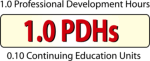
1.0 hour plus Q&A (no restrictions on time limit for extra Q&A!)
A Record of Attendance Form is included free with each webinar for your record keeping and individual PDH verification. We ask your on-site coordinator to return the completed and signed copy of the Form to us following the webinar for (1) maintaining a separate copy as a service to attendees and (2) forwarding to NIU confirming attendance for those who order certificates.
Attendees may also order an official a Course Completion Certificate from Northern Illinois University for a small administrative fee. The Certificate is optional and may be ordered separately following the webinar to confirm your attendance and showcase the certificate on your office wall. Instructions for ordering certificates are given during the webinar.
* This webinar is eligible for the 'BUY THREE, GET THREE' discount; however ANY webinar series discount shown above cannot be combined with it.
Attendees will be invited to actively participate during this live and interactive on-line web seminar. Discussion is planned following the webinar for those who want to continue the session. Bring your questions to the webinar and present them to the instructor and other participants for exploring the best solution.
Instructors Bio
Ron Hall
Ron Hall is nicknamed the "Google Geek" by his 18-year-old daughter. He is a member of Google Earth's Outreach Trainers forum, a Google certified "Featured Content Provider" for Google Earth, a Street View Trusted Photographer, and was designated a "Super Modeler" by Google for his 3D visualization work with SketchUp software. Ron is certified with Google Apps for Education/Nonprofits, and helps a wide variety of nonprofits and educators develop, organize, maintain, and track their interactive web mapping content. In his "spare" time, he is an online instructor in Eastern Washington University's GIS certificate program and does freelance interactive kml development/3D GIS visualization with his company - Evans-Hall, Inc. Prior to his work as a "web technologist"/consultant/trainer - Ron spent over 20 years in as a general contractor specializing in golf course construction and renovation. He was responsible for many large projects (public and private) that required working and communicating with various engineering and architectural firms. A believer in self improvement/continuing education, he has degrees from Princeton, Wharton, Cornell, Penn State, and Eastern Washington, and often tells people "that when you don't learn anything you have to keep going back to school".
No Worry Guarantee
If you can not attend the Live event, we will send you an email with instructions on how to access the On-Demand version.
You will receive this email a day-or-two after the Live Event airs and the On-Demand version is usually available within a week-or-so of the Live Event.
Simply click-on the 'Register' button and check the box 'I can not attend' located next to the 'Contact Email Address'.
Members Login
Become A Member
It's Free, It's Easy and as a Member you'll enjoy...


 Ron Hall is nicknamed the "Google Geek" by his 18-year-old daughter. He is a member of Google Earth's Outreach Trainers forum, a Google certified "Featured Content Provider" for Google Earth, a Street View Trusted Photographer, and was designated a "Super Modeler" by Google for his 3D visualization work with SketchUp software. Ron is certified with Google Apps for Education/Nonprofits, and helps a wide variety of nonprofits and educators develop, organize, maintain, and track their interactive web mapping content. In his "spare" time, he is an online instructor in Eastern Washington University's GIS certificate program and does freelance interactive kml development/3D GIS visualization with his company - Evans-Hall, Inc. Prior to his work as a "web technologist"/consultant/trainer - Ron spent over 20 years in as a general contractor specializing in golf course construction and renovation. He was responsible for many large projects (public and private) that required working and communicating with various engineering and architectural firms. A believer in self improvement/continuing education, he has degrees from Princeton, Wharton, Cornell, Penn State, and Eastern Washington, and often tells people "that when you don't learn anything you have to keep going back to school".