
NEW WEBINAR
Permeability Mapping of Glacial Deposits:
Demystifying the Conventional Overreliance on Grain Size and Understanding Ground Water Flow
Estimating permeabilities and ground water flow based on grain size alone may be the single largest mistake in our industry.
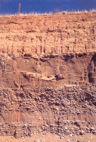
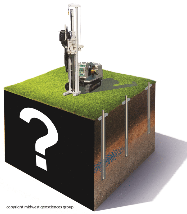
Too often grain size or permeability is the sole factor for trying to understand ground water movement and contaminant migration. And more often than not, boring logs and cross sections simply depict aquifers and aquitard formations when in reality, multiple factors are playing the role in ground water flow.
 Understanding permeability is at the core of all groundwater projects. There are many great tools and techniques for determining permeability however uncertainty prevails when we over rely on grain size alone to characterize the hydrogeologic system.
During this webinar, we are going to apply the previous webinar sessions about depositional environments and post-depositional weathering to basic strategies for understanding geologic context for permeability and ground water movement - and avoid common mistakes that fail to characterize the hydrogeology.
We will validate the principles from Environmental Sequence Stratigraphy and add the critical components applied to characterizing the hydrogeology of glacial deposits. When you're finished with this webinar series, you can begin taking the mystery out of the subsurface ® at your sites.
Apply the webinar principles to:
- Discovering what controls the distribution of formation permeability
- Clarifying the difference between permeability and preferential pathway
- Ensuring monitoring wells are installed in the same unit
- Preparing reliable potentiometric surface maps
- Identifying the downgradient monitoring unit
- Considering the geology when designing a remediation system

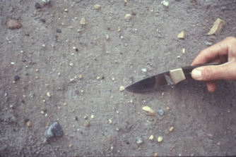
Regardless of the soil classification system you use, conventional correlation of units defined by grain-size or soil classification alone to permeability mapping may be the most common error in our industry.
 What factors control ground water movement besides grain size?
Clayey sediments may seem inherently like an aquitard, but ground water and contaminants are capable of moving laterally at high rates through fine-grained sediments under some circumstances. This webinar series will clarify this circumstance.
Sandy sediments are not always the preferential pathway or appropriate ground water monitoring units. Buried sand and gravel may or may not be preferential pathways for lateral ground water or contaminant movement. This webinar series will clarify this circumstance too.
What concepts are used when evaluating permeability?
Many lab and field analysis methods are proven successful (Hazen, 1892; Kozeny, 1927 and Carmen, 1956; Terzagi and Peck, 1964; Kenney et al., 1984; Alyamani and Sen, 1993) for predicting permeability from grain size distribution parameters using empirical equations. Despite the success for assigning a reasonably-reliable estimate of permeability to sandy soils, these methods are can be mis-used during hydrogeologic projects.
 RECEIVE A FREE
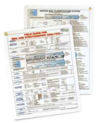
FIELD GUIDE FOR SOIL AND STRATIGRAPHIC ANALYSIS
with each registration.
Additional copies may be ordered for only $10 each
(plus shipping).
 OPTIONAL ADD-ON
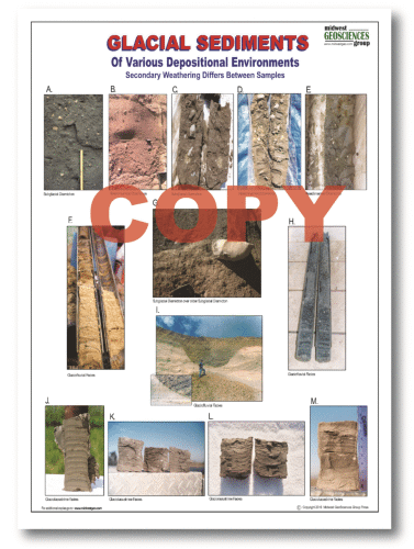
GLACIAL SEDIMENTS LAMINATED CHART (12" x 18")
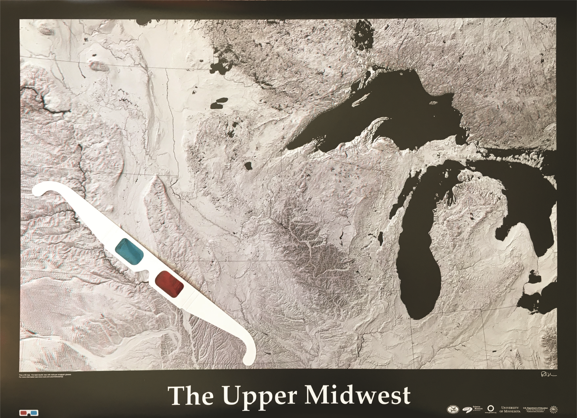 FREE 3D MAP
THE UPPER MIDWEST
Pay Only Shipping
Limit 1 Map per registration
Click Here for larger view
| Fee: |
299.00 USD Per Computer Site (unlimited participants per site)
249.00 USD Per Computer Site for our Members
99.00 USD Per Computer Site (unlimited participants per site)
when Members register for the Series:

(discount will be applied during checkout based on your cart)
Pay one site registration fee and an unlimited number of participants from your organization can attend at that site.
|
| Instructor: |
Dan Kelleher, PG, CIPM and Tim Kemmis, PhD, PG |
|
| Handouts: |
Copy of Webinar Slides (pdf)
Record of Attendance Form (pdf)
|
| Duration: |
1.5 hour plus Q&A
(no restrictions on time limit for extra Q&A!)
|
Professional
Development: |
Earn 1.5 Professional Development Hours (1.5 PDH)
 |
A Record of Attendance Form is included free with each webinar for your record keeping and individual PDH verification. We ask your on-site coordinator to return the completed and signed copy of the Form to us following the webinar for (1) maintaining a separate copy as a service to attendees and (2) forwarding to NIU confirming attendance for those who order certificates.
Attendees may also order an official a Course Completion Certificate from Northern Illinois University for a small administrative fee. The Certificate is optional and may be ordered separately following the webinar to confirm your attendance and showcase the certificate on your office wall. Instructions for ordering certificates are given during the webinar.

* This webinar is eligible for the 'BUY THREE, GET THREE' discount; however ANY webinar series discount shown above cannot be combined with it.
Attendees will be invited to actively participate during this live and interactive on-line web seminar. Discussion is planned following the webinar for those who want to continue the session. Bring your questions to the webinar and present them to the instructor and other participants for exploring the best solution.
Instructors Bio
Dan Kelleher, PG, CIPM
 Dan Kelleher, PG, CIPM is a consulting hydrogeologist and project manager focuses on the technical areas of quantitative hydrogeology (in porous and fractured media), geotechnical analysis of sedimentary sequences, aquifer testing, fractured rock hydrogeology, and predictive ground water modeling. Dan's business acumen promotes personal trust, integrity, and relentless QA/QC.
Dan started his career at Waste Management Corporate Headquarters in Oak Brook, Illinois. His worked allowed him to test geologic concepts about sedimentary processes during large-scale excavation and fill design, environmental and geotechnical investigations, ground water monitoring system design.
Dan also leads specialized technical teams establishing best practices and teaching educational courses and webinars for geologists, engineers and environmental scientists. He and Tim Kemmis are the co-founders of Midwest GeoSciences Group which helps professionals to do better job of TAKING THE MYSTERY OUT OF THE SUBSURFACE. He and Tim believe in that tagline so strongly that they own it as a federally-registered trademark.
Midwest GeoSciences Group allows Dan to help people not only be better scientists and engineers, but become better people. It is a privilege to collaborate with people on a spectrum of topics ranging from field tool development to cutting-edge engineering advances to environmental regulation input. Dan is motivated by serving others in order to fulfill our human purpose and achieve responsible global stewardship.
Tim Kemmis, PhD, PG
 Tim Kemmis, PhD, PG is a Senior Hydrogeology Consultant and Project Manager for large-scale hydrogeologic investigations. His unique experience as both an applied researcher and consultant has enabled Tim to effectively teach staff at all levels how unravel sedimentary complexities by making fundamentally sound observations, preparing complete and accurate boring logs and confidently correlating geologic units.
Tim received his bachelor's degree in agricultural soil science from the University of Illinois and his master's degree in glacial geology while working as a graduate assistant at the Illinois State Geological Survey.
He worked 14 years for the Iowa Geological Survey, during which he received his Ph.D., and where he:
- Carried out glacial sedimentologic investigations
- Remapped the Des Moines Glacial lobe
- Established the formal glacial stratigraphy for the lobe based on depositional environments
- Discovered a new type of hummocky glacial topography
- Determined the geometry and origin of jointing in glacial tills
- Developed a lithofacies code to decipher the history of glacial outwash and alluvial sequences
Tim is a co-founder of Midwest GeoSciences Group and has successfully taught many courses and webinars dedicated to improving boring logs and helping geologists think on their feet.
